GPS Equipped Radio Controlled
Sailplane HOWTO
Table of Contents:
Garmin GPS
Garmin to PC interface
Plotting software
Topography data
Aerial Imagery
Parts
List
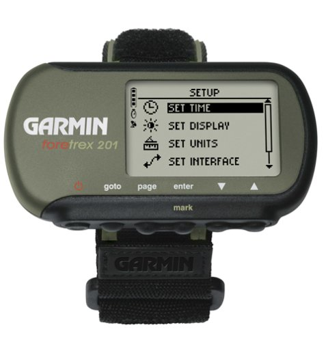
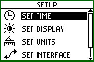
Garmin Foretrex 201
First things first, you need a decent small GPS receiver. I
suggest the Garmin
Foretrex 201 GPS receiver
because it is small and light, it is
WAAS capable for 3 meter accuracy in all three axes, and is capable of
storing 10,000 measurements in the internal flash memory. I
shuttled off to REI to get
one. It set me back about $170, but I figured it was a small
price to
pay for something with so much capability. Later I found
you can get them from amazon.com for $150 or so.

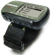
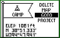
Let me tell you, this is one cool gadget. It weighs 2.8oz and is
about the size of a large RC receiver. It's waterproof and
has a 15 hour internal lithium rechargeable battery. The foretrex
comes with a serial cable for downloading the recordings to a PC, but
it didn't come with any software. I pondered what to do...
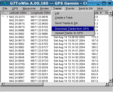
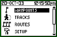
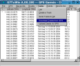
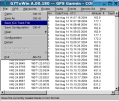
G7toWin
No problem, you need to get a package called G7toWin if you are using
Windows (gpspoint
on Linux). It is a
freeware program that knows how to talk to Garmin GPS receivers.
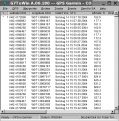
I downloaded the code and hooked up the GPS unit to serial port COM1 on
my computer. It was easy enough. I just clicked on
"Download tracks from GPS", then "List", and there were the
GPS data points on my screen. That was no sweat, but what I
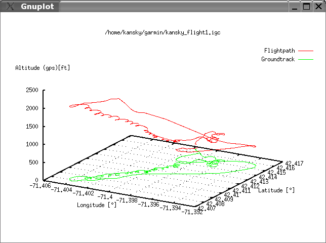
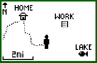
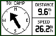
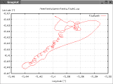
really wanted to do was to plot the flight so that I could visualize
where I was flying, how high I was launching, and so on. I tried
to find a package to do this on the internet, but all of them were
commercial software, or cripple ware, and I didn't really want to shell
out more cash for this project. After some more persistent
searching I found...
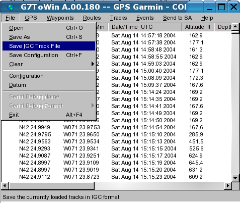
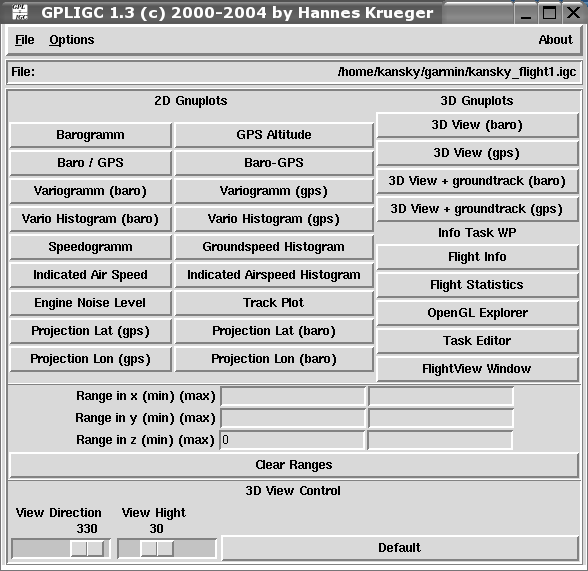
GPLIGC
Let me tell you, there are some great pieces of open-source
software out there. Not only is this one free, but the users can
examine the code, make improvements as needed , and finally contribute
their improvements to benefit all users. Using G7toWin I exported
my GPS tracks to IGC format and read them in using GPLIGC.
On Linux, you can use the gpsp2igc.pl perl script in the CVS
distribution of GPLIGC to convert the file from gpspoint to igc.

This was bit tricky to set up, but it wasn't too bad. The basic
software provides you with an interface to a plotting program called
GNUplot, and it also has a 3D visualization package called
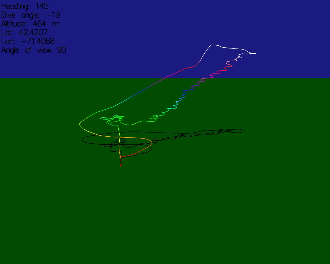
openGLIGCexplorer. The default setup for openGLIGCexplorer gives
you a nice 3D view using my computer's 3D graphics card.
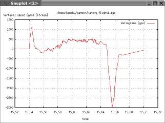
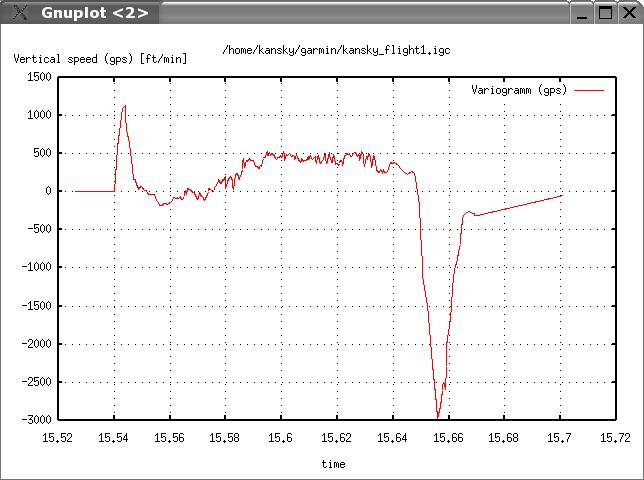
I was pretty satisfied that at least on this flight I didn't make any
rookie mistakes, but you might notice that I made the wrong descision
to go left off the winch launch when the lift was clearly to the
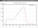
right. But it's hard to beat a 500 foot per minute climb to 2200
feet followed by a rapid descent designed to announce the completion of
a
max to the competition.
A bit more web searching and I found out that you can download 10 meter
resolution radar topography of the US, and 0.5 meter resolution aerial
imagery of Massachusetts on the internet. To complete the
job right you can overlay your flight on the topographic data and
aerial
imagery.
SRTM
The topographic data I used was measured on a shuttle mission called
the "Shuttle Radar Topography Mission". The files were available
in 1 degree squares covering the whole world. The 10 meter
resolution United States data could be obtained at the Shuttle
Radar Topography Mission Digital Elevation Model ftp site.
The lower resolution data for the rest of the world was in another folder on the same
site.
The data is in a zipped file in hgt format. The filenames are
determined by the bottom left coordinate of the region that is covered.
I ran it throug unzip and added the following lines to my
.openGLIGCexplorerrc file.
DEM_FILE
/home/kansky/GPLIGC-1.3/openGLIGCexplorer/N42W072.hgt
DEM_ROWS 3601
DEM_COLUMNS 3601
DEM_LAT_MIN 42
DEM_LAT_MAX 43
DEM_LON_MIN -72
DEM_LON_MAX -71
DEM_GRID_LAT 0.00027777777
DEM_GRID_LON 0.00027777777
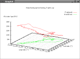
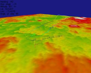
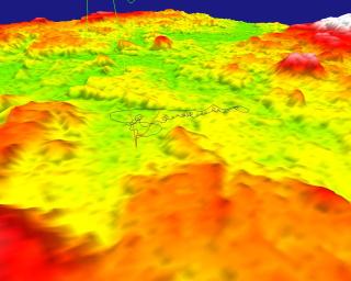
Adding the topographic data made the 3D plot look a lot better, but
it's a bit flat in this part of the world. With GPLIGC you can
also magnify the vertical scale.
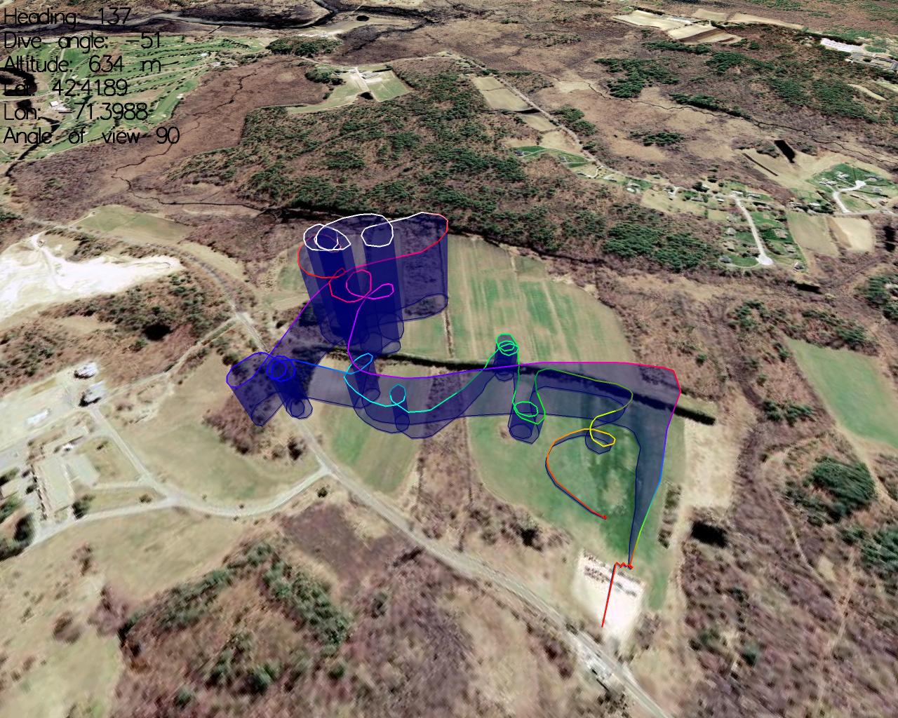
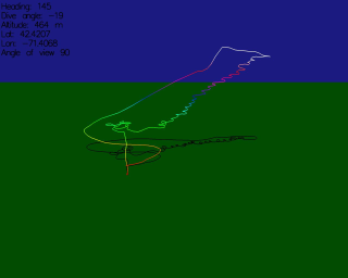
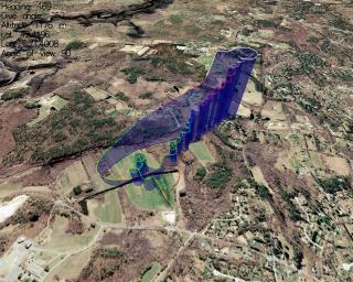
Finally things were starting to look good... The last addition to
the
picture would be to overlay some aerial photography on top of the
terrain.
MassGIS
If you live in Massachusetts, you are lucky because you can download
0.5 meter resolution aerial photos of the entire state for free at the MassGIS web
site. Choosing the correct file can be a bit tricky, but take a
look at the following map.
Once you know which file you will need you can get the file from their web site by
clicking on the map, and selecting the desired .sid file. In my
case, I download the four images that surrounded the flying field.
The GPLIGC program requires that the files be in JPG format.
There is a .sid to .jpg converter program available from LizardTech.
mrsiddecode -i 209906.sid -o
davis_tl.jpg -s 2
This command will generate a jpeg file downsampled by a factor
of two from the original 0.5 meter resolution file (the original
4096x4096 .sid files are a bit large to work with).
Adding the aerial images to GPLIGC is as simple as defining the
filename and the corner coordinates of the image in your
.openGLIGCexplorerrc file:
MAP_FILE /home/kansky/GPLIGC-1.3/openGLIGCexplorer/davis_tl.jpg
MAP_TOP 42.44048
MAP_RIGHT -71.39059
MAP_LEFT -71.43919
MAP_BOTTOM 42.40448
MAP_FILE /home/kansky/GPLIGC-1.3/openGLIGCexplorer/davis_tr.jpg
MAP_TOP 42.44048
MAP_RIGHT -71.34199
MAP_LEFT -71.39059
MAP_BOTTOM 42.40448
MAP_FILE /home/kansky/GPLIGC-1.3/openGLIGCexplorer/davis_bl.jpg
MAP_TOP 42.40448
MAP_RIGHT -71.39059
MAP_LEFT -71.43919
MAP_BOTTOM 42.36848
MAP_FILE /home/kansky/GPLIGC-1.3/openGLIGCexplorer/davis_br.jpg
MAP_TOP 42.40448
MAP_RIGHT -71.34199
MAP_LEFT -71.39059
MAP_BOTTOM 42.36848
To convert from state plane coordinates to geodetic coordinates use the
following the NGS
converter page.
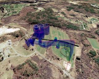
This config file stitches together 4 images to create the following
final result:
Hope this inspires you to give it a try yourself. Best of Luck!
Parts List
Garmin Foretrex
201 GPS receiver
G7toWin Garmin interface
software
GPLIGC Plotting
Software
Shuttle
Radar Topography Mission Digital Elevation Model
MassGIS aerial
imagery